NEWS
IMD Issues Widespread Rain Alert Across India; Heavy Downpours, Thunderstorms and Heatwave to Impact Multiple States
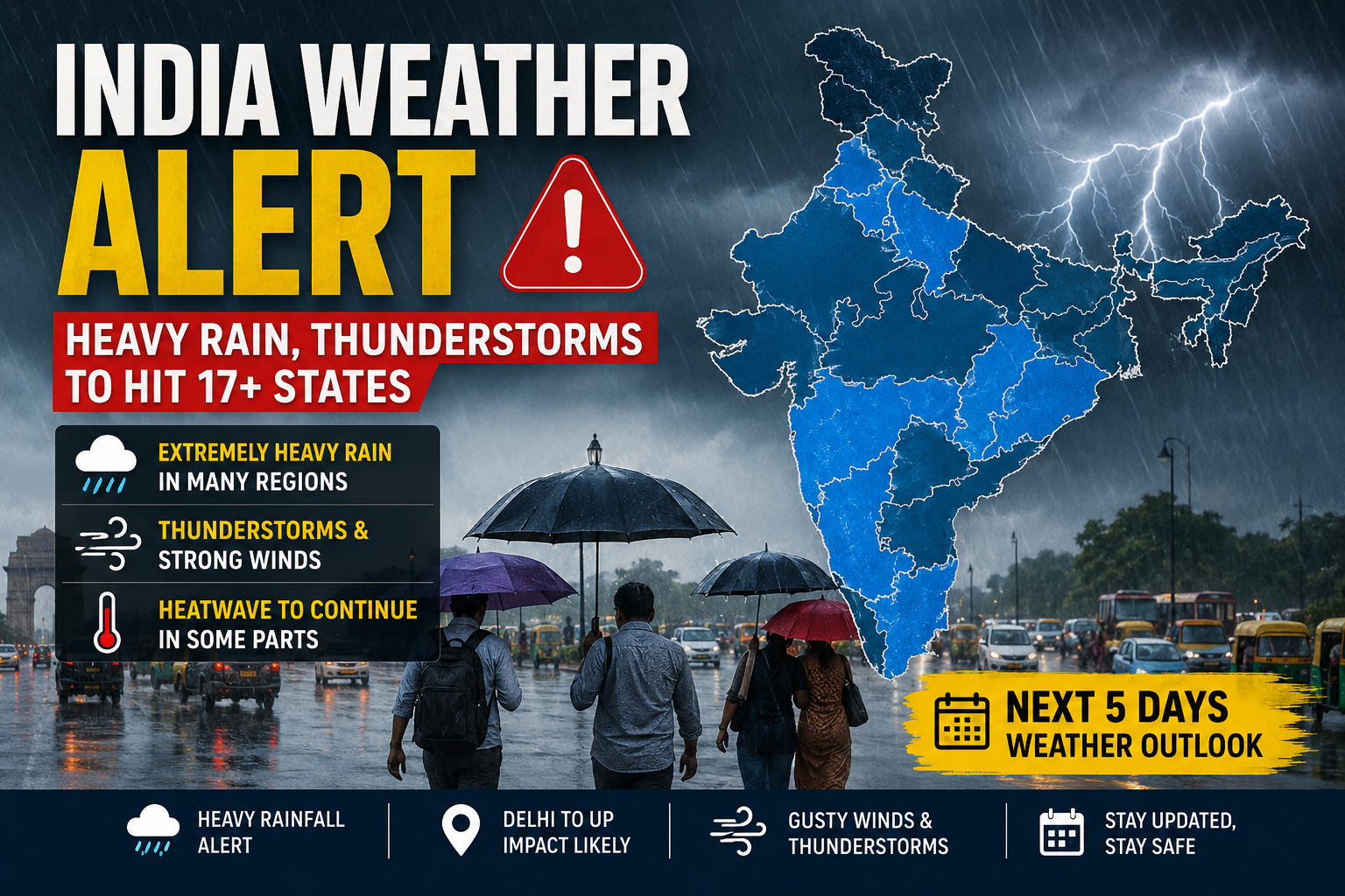
The India Meteorological Department (IMD) has issued a fresh weather advisory warning of widespread heavy to extremely heavy rainfall across large parts of the country over the next five days. As the southwest monsoon continues its rapid advance, more than 17 states are expected to experience intense rain, thunderstorms, lightning and gusty winds. At the same time, some areas in northern India, particularly parts of Uttar Pradesh and nearby regions, are likely to remain under heatwave conditions for another two days before temperatures begin to fall.
Southwest Monsoon Continues to Advance
According to the IMD, the southwest monsoon is steadily progressing across the country, bringing a significant change in weather conditions. The current northern limit of the monsoon stretches through Surat, Indore, Mandla, Daltonganj and Motihari.
Meteorologists expect the monsoon to cover additional parts of Gujarat, Madhya Pradesh, Chhattisgarh, Jharkhand, Bihar, Uttar Pradesh and Uttarakhand within the next two days. After that, it is likely to move further into Himachal Pradesh, Jammu & Kashmir, Ladakh, southeastern Rajasthan and the remaining areas of Gujarat over the following two to three days.
Extremely Heavy Rain Forecast for Several Regions
The IMD has warned that several states could witness episodes of very heavy to extremely heavy rainfall during the forecast period.
Sub-Himalayan West Bengal and Sikkim are expected to receive intense rainfall, with extremely heavy showers likely on June 29 and continued very heavy rain on June 30.
In Assam and Meghalaya, isolated locations may experience very heavy rainfall on June 29 and June 30, increasing the possibility of localized flooding and waterlogging.
Arunachal Pradesh is also expected to witness heavy downpours in several areas, particularly on June 29.
Along the Konkan coast and Goa, extremely heavy rainfall is forecast on June 29 and again between July 2 and July 3. Parts of Madhya Maharashtra are also likely to receive exceptionally heavy rain during July 2 and July 3.
Delhi-NCR and North India to See Changing Weather
Weather conditions across northwestern India are expected to change significantly as a fresh western disturbance becomes active from July 2 onward.
Delhi, Haryana, Chandigarh and Punjab may receive scattered rainfall between June 29 and July 1. However, rainfall activity is expected to intensify between July 2 and July 4, with heavy showers likely across many areas. Delhi-NCR and parts of Punjab may receive particularly heavy rainfall between July 1 and July 3.
In Uttar Pradesh, eastern districts are likely to receive heavy rainfall from June 29 to July 2, while western parts of the state may witness heavy showers from June 30 onward. Thunderstorms accompanied by strong winds reaching speeds of 40 to 50 kmph are also expected in several districts.
Uttarakhand, Himachal Pradesh and Rajasthan Under Watch
Uttarakhand is expected to witness widespread rainfall from June 29 through July 5. The IMD has specifically warned of very heavy rainfall on July 1 and July 2, raising the risk of landslides and flash floods in vulnerable areas.
Himachal Pradesh is also likely to experience very heavy rain on July 2 and July 3.
In Rajasthan, eastern districts may experience thunderstorms with wind speeds of 50 to 60 kmph on June 29. Heavy rainfall is forecast between July 2 and July 5, while western Rajasthan may witness dust storms during the same period.
Central India Likely to Receive Intense Rainfall
Several regions in central India are expected to receive widespread rainfall over the coming days.
Both eastern and western Madhya Pradesh are forecast to receive continuous rainfall from July 1 to July 5, with very heavy showers expected between July 2 and July 4.
Chhattisgarh is likely to witness heavy rainfall from June 29 to July 5, while Vidarbha may experience heavy rain through July 2, followed by very heavy rainfall on July 3 and July 4.
Bihar, Odisha and Jharkhand to Witness Wet Spell
Eastern India is also expected to remain under the influence of the active monsoon.
Bihar may receive heavy to very heavy rainfall between June 29 and July 1. Odisha is likely to experience very heavy rainfall from July 1 to July 4, while Jharkhand has been placed under a heavy rain alert for June 30 and July 1.
Southern States Also Face Heavy Rainfall Risk
The IMD has predicted widespread rainfall across southern India as well.
Coastal Karnataka is expected to receive very heavy rainfall at isolated places from June 30 to July 5. Kerala and Mahe may experience heavy to very heavy showers on June 29 and June 30.
Telangana is forecast to receive widespread rainfall through July 5, while southern interior Karnataka may witness very heavy rain between July 3 and July 5.
Heatwave to Continue Briefly Before Temperatures Drop
Despite the advancing monsoon, heatwave conditions are expected to persist in parts of eastern Uttar Pradesh over the next two days. Isolated pockets of Haryana, Chandigarh and Delhi may also continue to experience hot weather on June 29 and June 30.
However, the IMD expects temperatures to decline steadily as monsoon activity strengthens. Maximum temperatures across northwestern India could fall by 4 to 5 degrees Celsius by July 4. Maharashtra may record a drop of 3 to 4 degrees by July 3, while temperatures in Madhya Pradesh and Gujarat are also expected to decrease by 2 to 4 degrees in the coming days.
Advisory for Residents
With widespread rain, thunderstorms and strong winds expected across multiple regions, residents are advised to monitor official weather updates, avoid unnecessary travel during severe weather events, and take precautions against waterlogging, lightning and localized flooding. People living in hilly areas should remain alert for landslides, while those in heatwave-affected regions should continue to stay hydrated until cooler conditions arrive.